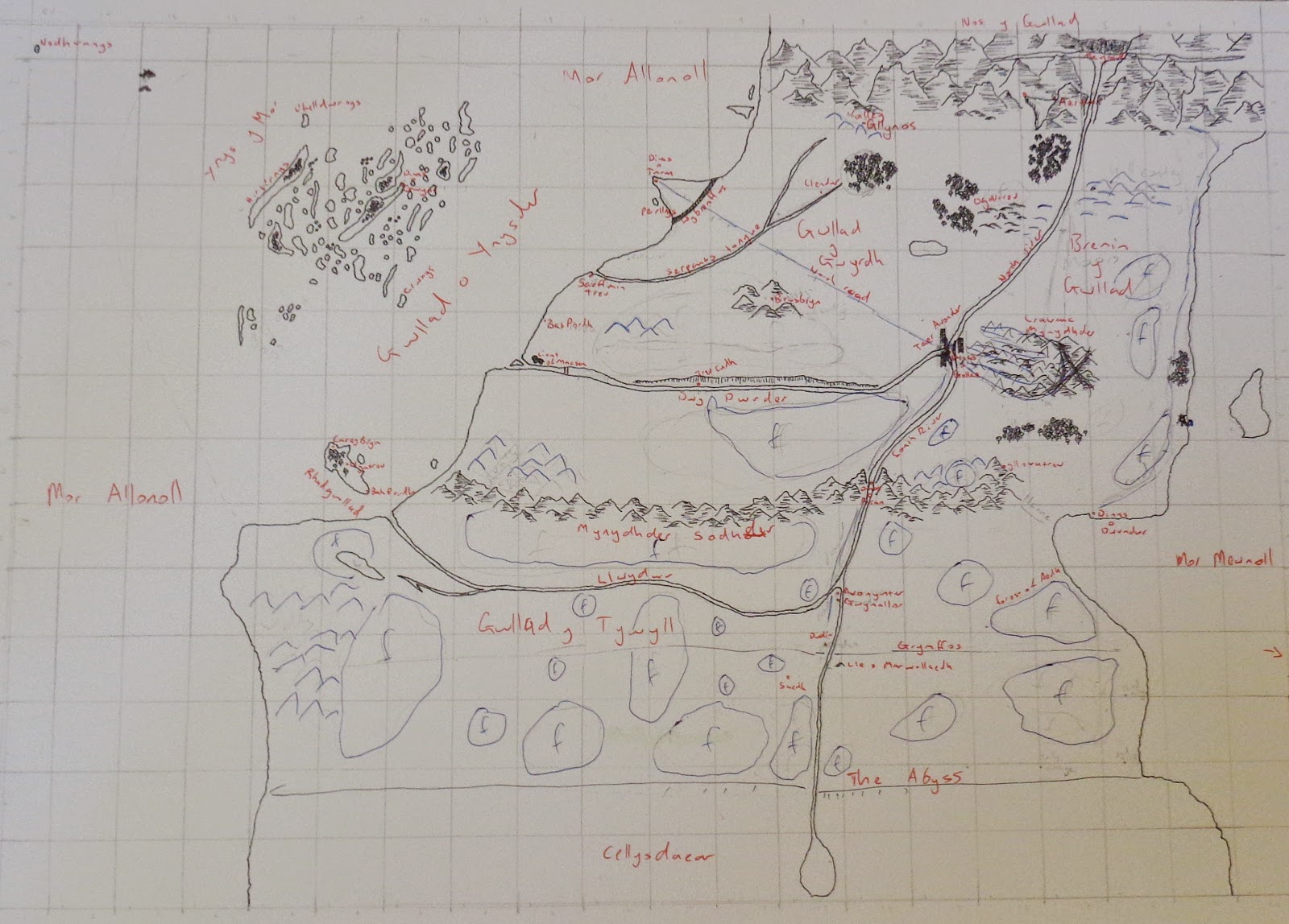
So where do you begin with map drawing, well firstly just
put your pen to paper and let your imagination flow.
Your first map is simply putting your ideas down, roughly
setting out where everything in your world is; it is best to think of this as
your first draft. Once you are done with the first draft you will want to turn
your attention to distance. I find that the best way to manage distance is to
make up a ruler for yourself.
I use a small piece of coloured paper with markings set
0.4cms apart; each marking represents a day’s travel. I then use this ruler to
count the distance between places on my map. Now here comes the tricky part,
you may wish to count the day’s travel as the distance a person can walk in 12
hours or the distance a horse can travel in the same time. Personally I choose
to go with a horse because in my world that is the main mode of transportation.
As you may or may not know a horse can travel in a variety of ways which affect
how far it can in 12 hours. I have researched this and have come up with an
average from which I work.
A horse walks on average travels at 4 miles per hour which
means in 12 hours a horse can travel 48 miles. Trotting is 8mph which covers
96miles and a canter is 16mph which covers 192miles. As for a horse pulling a
carriage they travel at around 2mph covering 24miles in a day.
Now most people will ride a horse at a walk when travelling over
long distances therefore I set my ruler against a horse walk meaning that they
0.4cms becomes 48miles. Therefore whenever I measure the distances between two
places on my map I not only know how many days it would take a character to
travel between them but also the distance it is. This not only allows to now
make changes to my draft according to the distances I prefer but also to be
able to write appropriate times for travel in my book.
But what if the characters travel at a canter sometimes or
have to walk you may ask, well that is precisely why we chose a mode from which
the days travel is set. Now that I have decided my 0.4cms is equal to 48miles I
can calculate the distance and from there work out what the same distance would
be at a walk or a canter. For examples say from A to B is 960miles, 20days by
horse walk, to work out how long that would take as a canter simply divide 960
by 192 which gives you 5days, similarly a person walking is 960 divided by 36
which equals 26.6days. As you can see it is pretty straight forward.
Now once you have made changes according you your preference
for distances you will want to draw up a second draft. You can either do this
freehand again or as I prefer draw up grids on top of your first draft and do
the same on the paper you will use for your second. Note that if you need to
expand your map for the second draft you will need to do some calculations
around grid sizes and numbers. Once you are done it’s a simple matter of
drawing grid by grid a copy of your map, with reference to your distance
changes of course.
This second draft usually ends up being the one I use when writing,
and as you can see it may or may not be fully complete in terms of drawing, the
parts in blue are features which will be fully drawn in my final map.
At some point you will want to create the final map the one
which will either appear in your printed book or on your website. Once again
you will want to draw up a grid and do as you did between your first and second
draft. Now I suggest you leave this final map free from text, unless you have
superb hand writing and do not need to change anything from one book to another.
As you can see from the above pictures you can add text
after scanning which essentially makes your map into an infinite number of
maps. This is particularly useful for tracking a visual history of the rise and
fall of kingdoms and countries.
Just a few more notes on maps and distance and then we are
done. Now you may wish to make close up maps for each book if they are taking
place in different regions of your world or you may wish to make small rough
maps of certain cities and locations to get your head around directions and
layouts, I often do this for large cities, palaces, or forts. You may also wish
to do a more stylised map like the below with key landmarks drawn in icon.
Lastly a few suggestions on distance, every so often your
characters may find themselves straying from the roads in which case it is good
to add days on to journeys. Now it is up to you how many you think are needed
but as a rule of thumb I add on 2days for cross country, 3days for snow, and
4days for mountains, all of these of course can be added together if your
character is travelling cross country in snow then into the mountains. It is
just another way to add more realism to the times taken in your story.
So that’s all I have to say on maps and distance, next week
we will be looking at climates and how to construct a calendar for your world.


0 comments:
Post a Comment